Free Content Library · Charts & Models
Upper Air Charts
1 min read · NOAA National Weather Service — JetStream
Any time there is a rapid change in a particular weather element, we will say the "gradient" is large. It is near these large gradients where the weather is most active.
A common example is found near cold fronts. The change in air pressure is typically rapid near a cold front, and, therefore, the pressure gradient is large. The greater the pressure gradient is near a front, the stronger the wind. This is also true for the upper atmosphere.
While the information provided by a Skew-T chart is invaluable, it can only tell us what is happening in the atmosphere at that location. To paint a complete picture of the atmosphere as a whole, we need to view radiosonde data from many upper air observations.
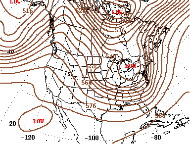
We do this by creating constant pressure charts that let us see changes and gradients in atmospheric conditions across the country and around the world.