Free Content Library · Upper Air & Soundings
Upper Air
1 min read · NOAA National Weather Service — JetStream
The term "upper air" refers to the earth's atmosphere above about 5,000 feet (1,500 meters). It is from the upper air that we get our rain and drought, wind and calm, and heat and cold at the Earth's surface.
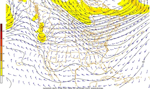
The map below is a picture of the state of the atmosphere for a particular time at a constant pressure level of 500 millibars (about 18,000 feet in altitude). The lines represent the locations of various higher and lower pressure regions in the upper atmosphere.
While upper air maps like this (and following information) can be complicated, this is the "meat and potatoes"' for meteorologists.
All weather forecasts stem from our understanding of the upper air, where weather patterns such as ridges, troughs, upper air disturbances, and upper-lows occur and are moving.